
access all exchanged documents on the cloud:

project and territory
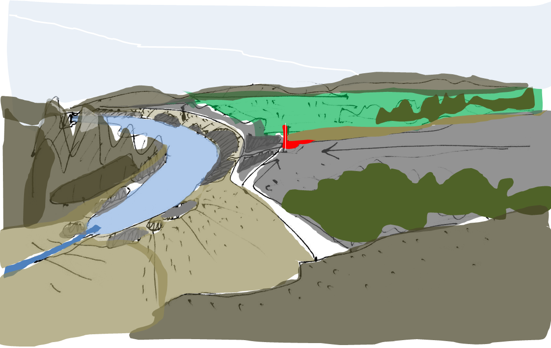
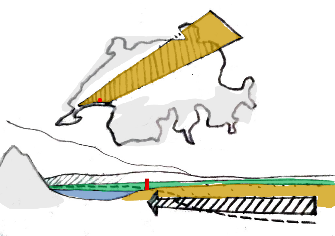
between the undulating jura mountain and the pics of vaud alps, Lausanne is implanted on the north side of the Leman lake, on the slope decreasing from the tectonic zone (horizontal sandstone) of the Swiss plateau.
the site allows a 180◦ view from one to the other.
project and territory

context
context with the AquaEcoPole


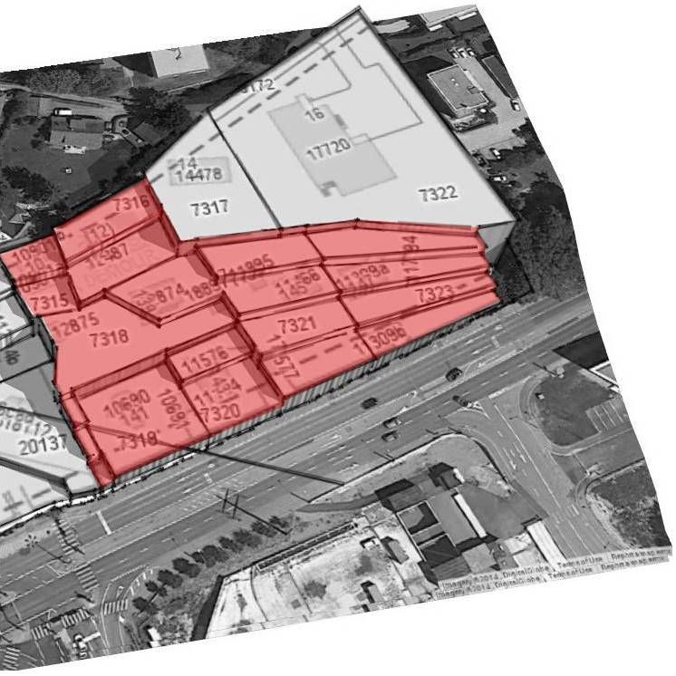
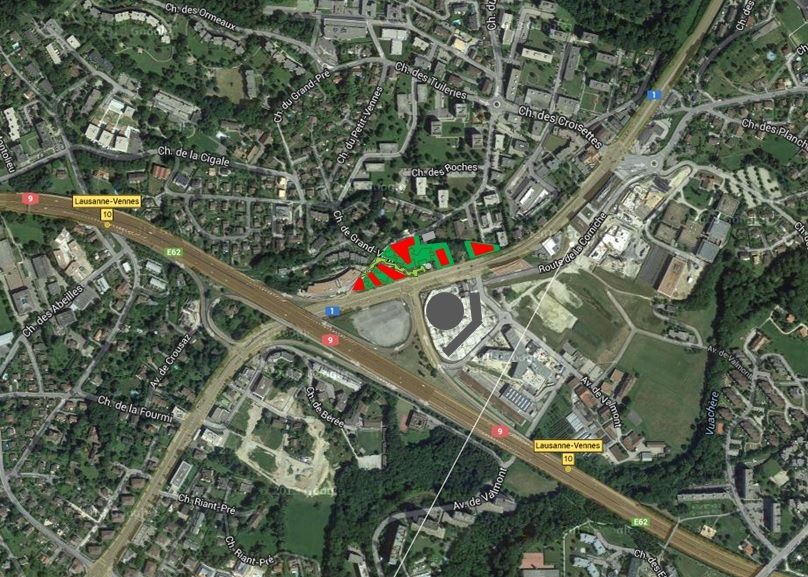
plots and topography
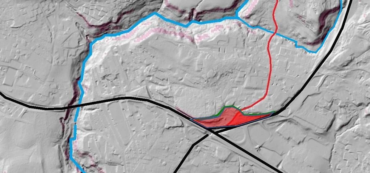
geomorphology
surrounded by the groove of the "Flon" river and the plateau, the conch of "Vennes" clearly appear on this model.

concept
-
emerging from the geomorphology the project is precisely implanted, ideally oriented South with full benefit to the sun and view.
-
formed from the Swiss plateau on the decreasing steps of the tectonic zone called "horizontal sandstone", the project recognizes the local plateau, the conch and the slope under the listed trees of the woodland cord.
- it realizes a landmark for the north entrance of the city.
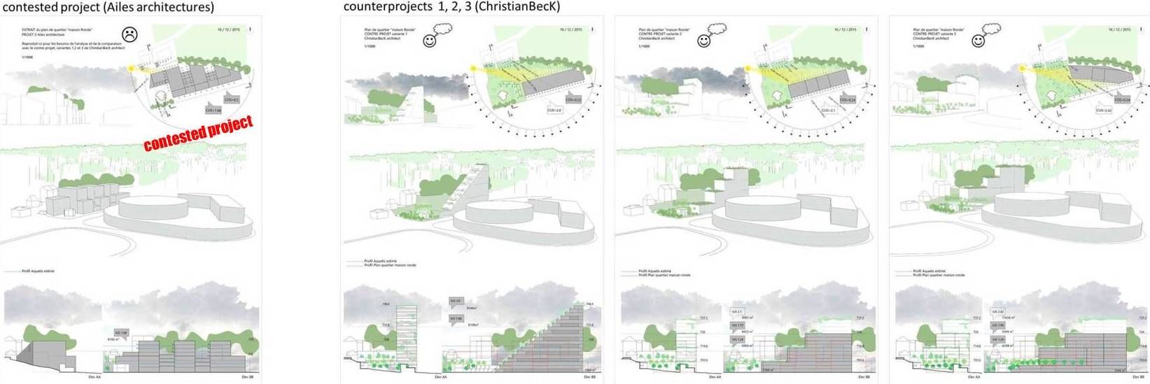
comparison
-
3 counter-projects variations are provided to demonstrate that the COS can be reduced by 2 and the CUS raised by around 20% if a project is designed according the geomorphology, the sun orientation, the view and the built environment.
- the 3 variations of the counter-project are implanted in the slope between the road and the plateau, free of the plots pattern in order to keep the conch available for a green area.
next pages show each variations separately with green zone, view angle, and benefit from the sun orientation.

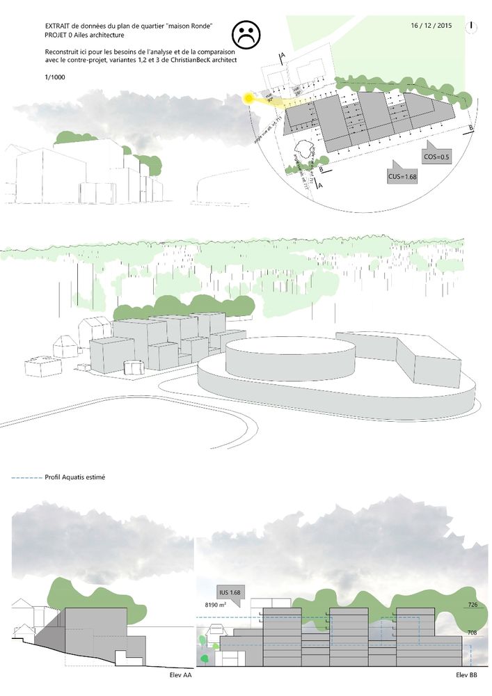

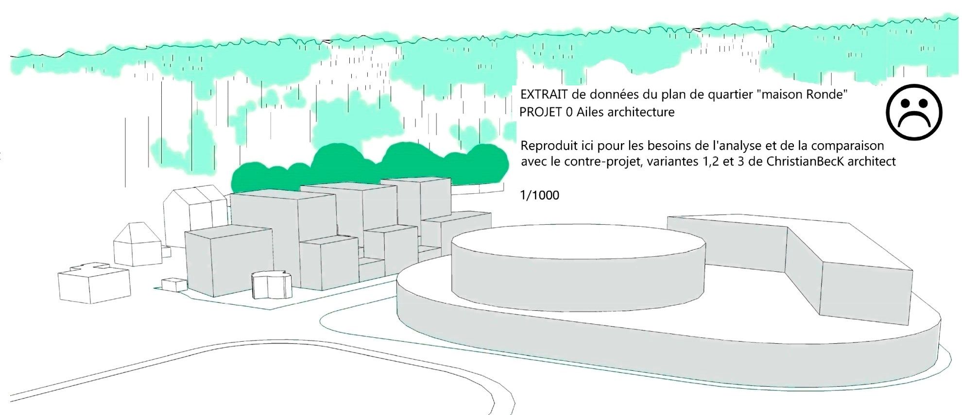
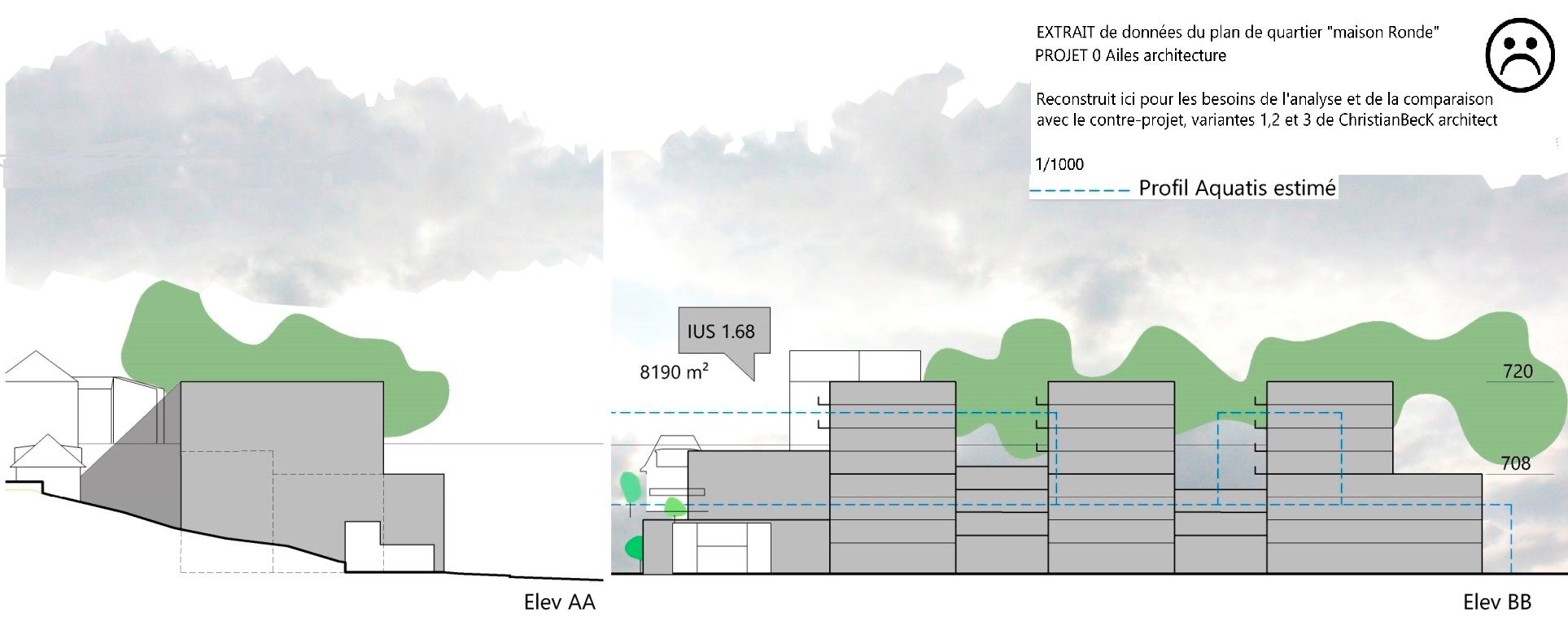
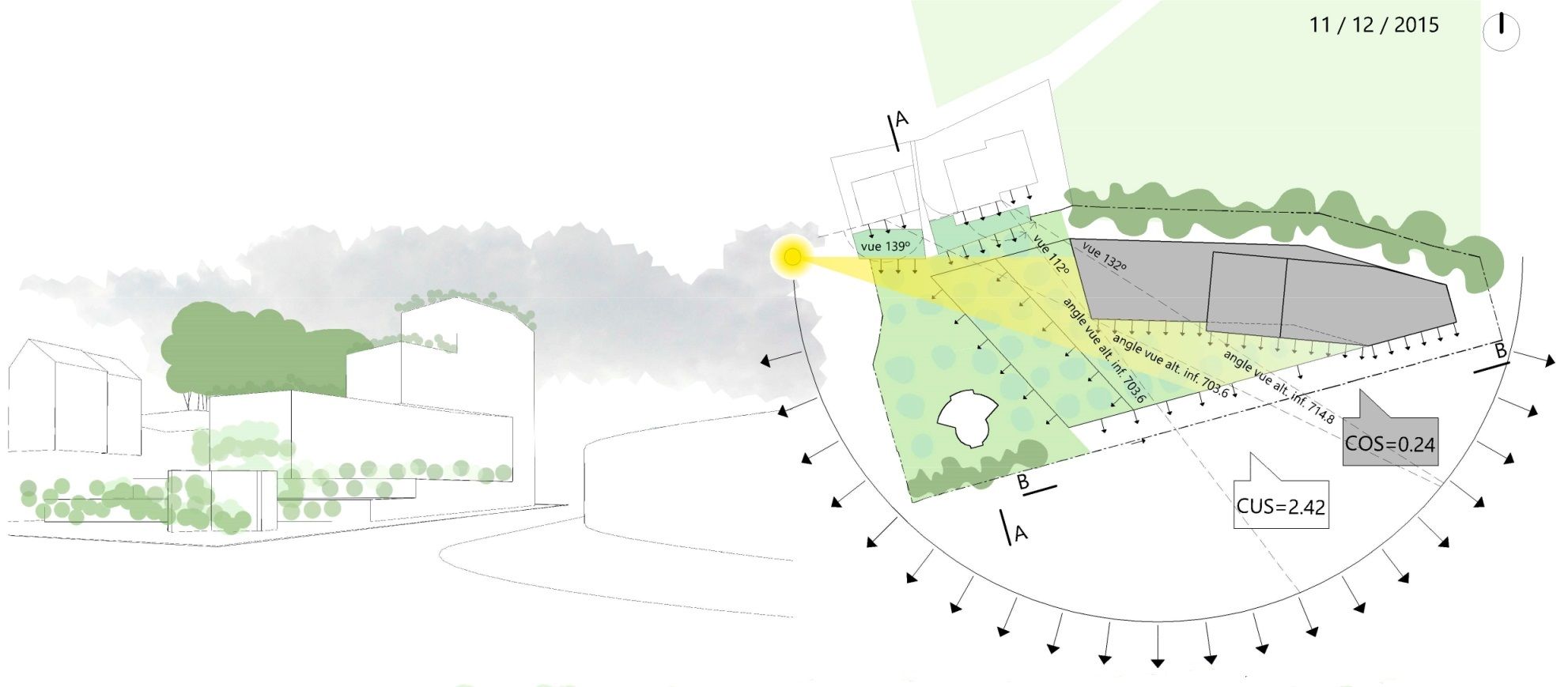
contested project 0.0
-
Issued from some owners's stratagems in which the neighbors have been evinced, and the involved plot owners fought for/against the setup of a plan of quartier, this one circumvents the constraints at the expenses of third parties.
-
first design according a longitudinal apparatus along the regional road, then profiting of an ideal south orientation (passive solar and energy saving) as well as a maximum view from the Vaud alps to the city of Geneva in the end of the lake...
- the project orientation has been modified in a "comb" apparatus, perpendicular to the road… within the single (and not understandable) aim to integrate the plot 7321, for which a building authorization had been delivered, though the said authorization was cancelled by the Court... and though it then allowed the developers to run a global concept they had applied for...???
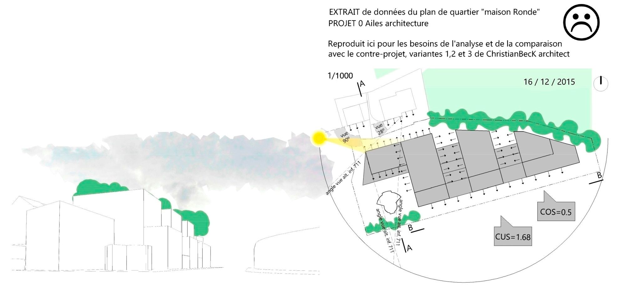

contested project 0.1
-
the registered woodland cord is hidden by the built volume.
Ignored by this non-sense project, "the round house" though promised for quality development to the past owners and though registered as a protected historical building, appears at the bottom of the project like a dog house. -
the comb typology perpendicular to the journey of the sun is aberrant: the lateral elevations without any view, front the opposite building and are only sunned for 3.5 daily on 80% of their surface.
- stuck in his exclusive ploy, the project uses of the maximum authorized ground surface (according the standard regulation) to reach a 0.5 coefficient and a respective poor 1.68 utilization coefficient CUS... relegating the hypothetical green area in the north shadow of the building...where nothing would grow..!

contested project 0.2
- a volumetry which is just the result of the implantation according the plot pattern, as the consequence of protagonists disagreement) only raise at 24m. without providing any quality space at all.

contested project 0.3
- an unapproprite filter in such a situation; unsufficient spaces between the buildings for a height which has raised from 13m to 24m such designed by the office (Ailes architecture).

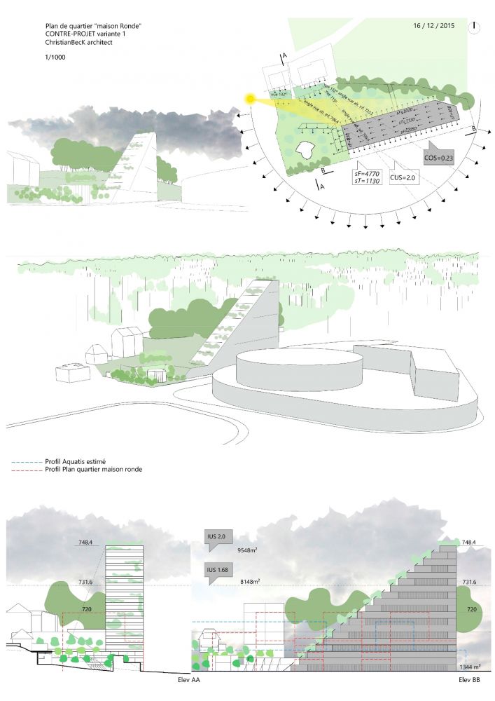
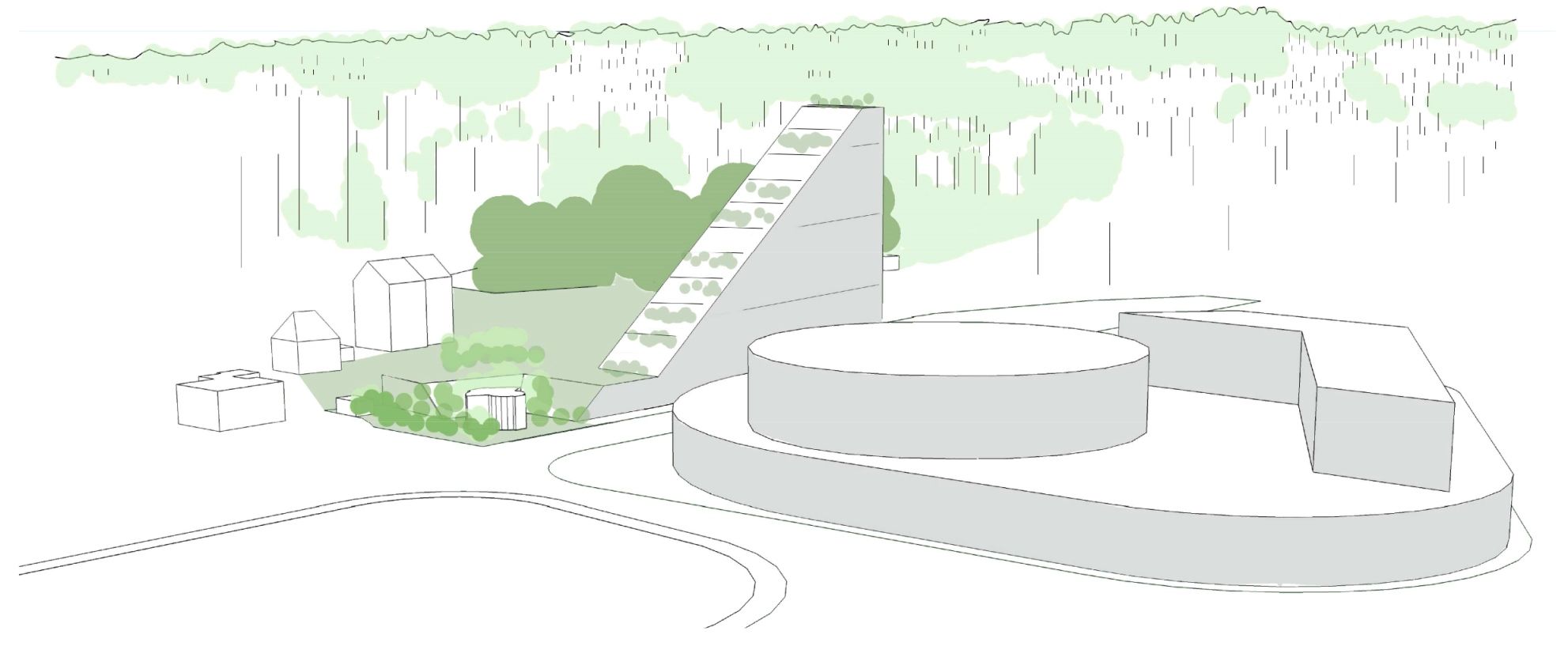
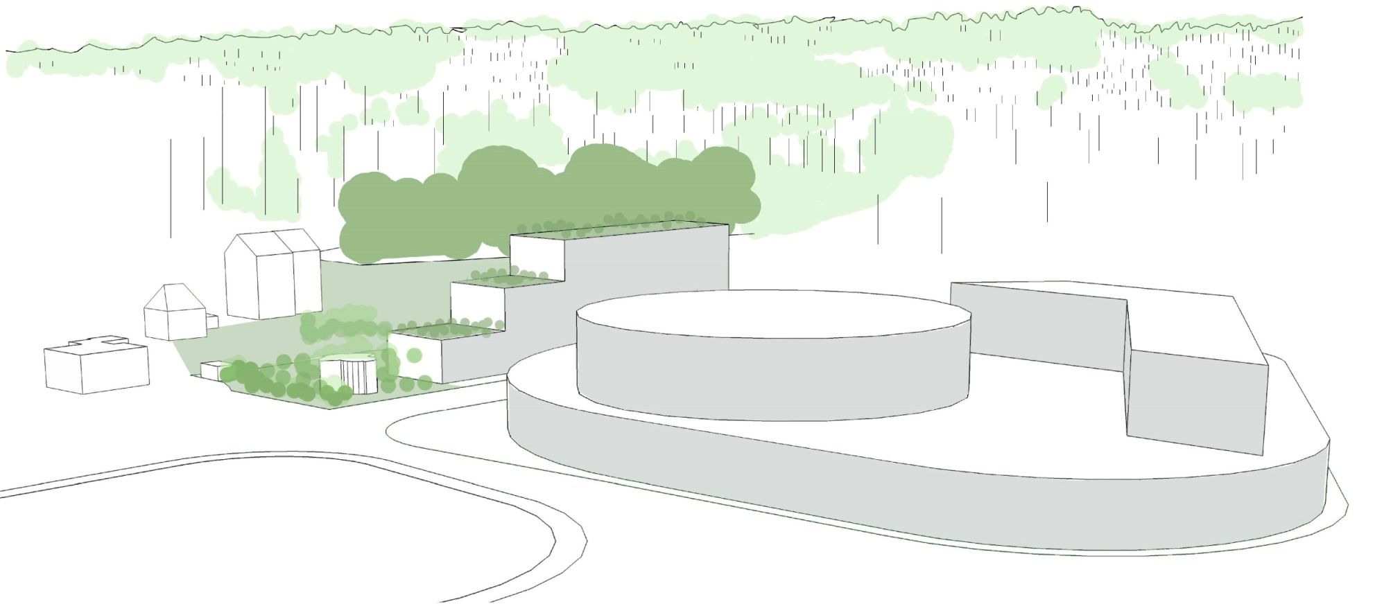
counter-project 1
-
the volume ascends from "the protected small round house" realizing a front along the road. The view angle from the houses on the back is still open.
-
this variation presents a triangular volume challenging a composition with the AquaEcoPole by the simple unicity of the shape.
- apartment with green terraces are opened on the sloping West elevation.
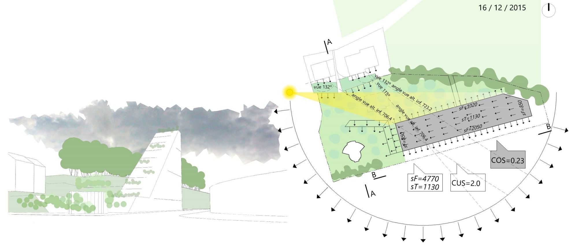
counter-project 1.1
- view from the highway exit
- plan and related data
- the ascending volume is the highest of the 3 variations but offers a wide space and a view on the trees of the registered woodland cord.
- this solution preserves the view from the plots 7315-7316 on the back within an angle of 115 to 132 degrees.
counter-project 1.2
- the triangular volume is directly issued from the west to east ascending concept. in this configuration, the building focuses on the composition with the AquaEcoPole complex, in order to participate to the city north gate image rather than with the residential zone.
counter-project 1.3
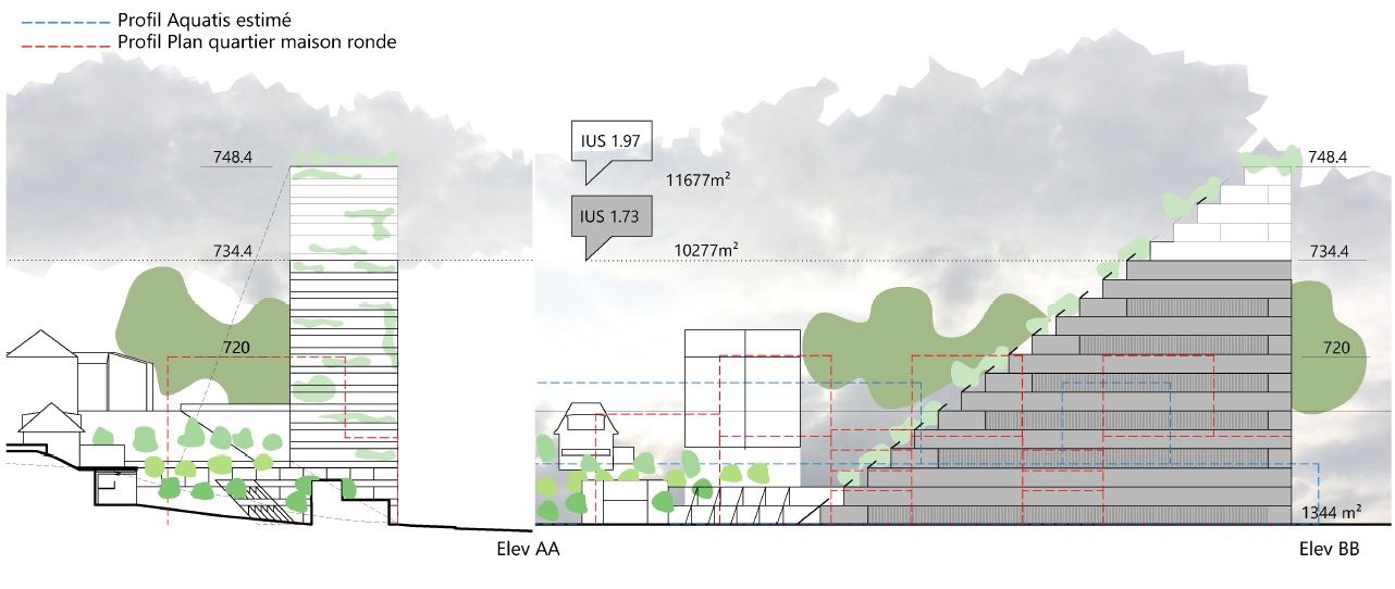
- the CUS 2.0 (built coefficent) is reached at the altitude of 748m realizing a "landmark" for the north entrance of the city.

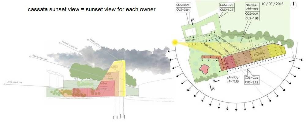
an added advantage of this concept:
-
the view on the West (sunset view particularly nice on the Jura mountain) whose each plot owner get profit... thanks to the ascending apparatus.
- the apparatus is also very interesting for an equal added value of each plots and moreover for the investor or group of investors in the sharing of the project... as all of them will have the benefit of the same advantages

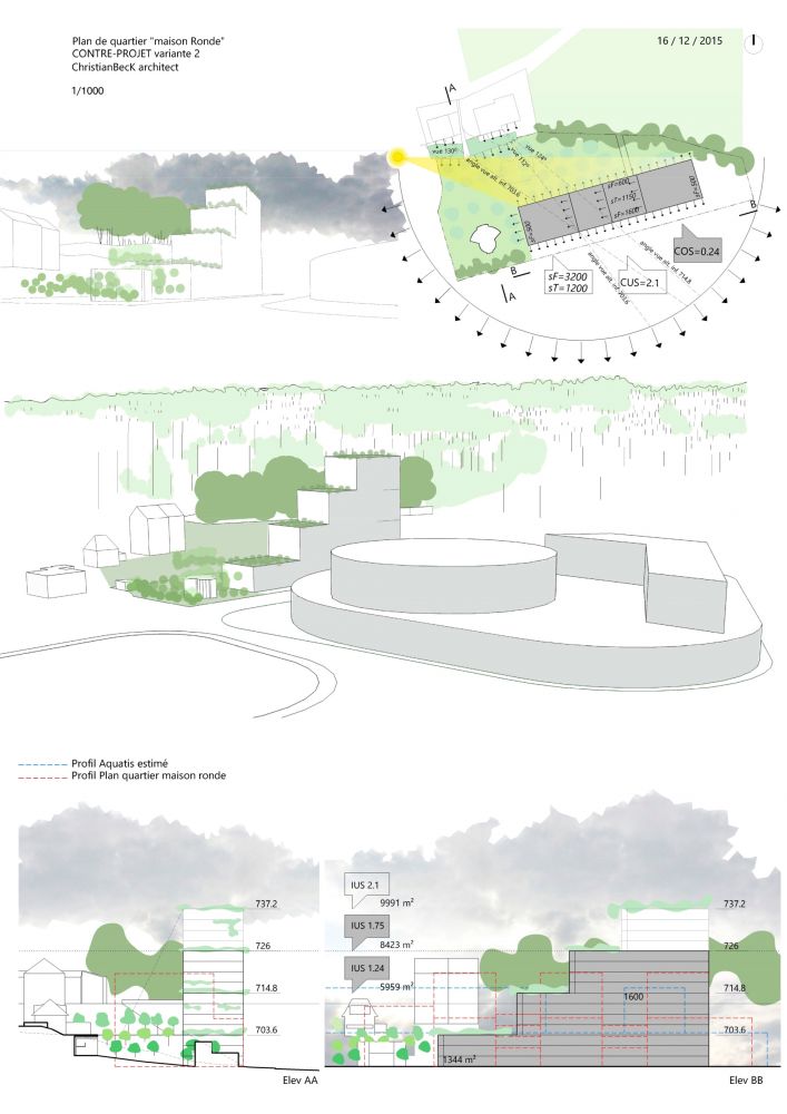
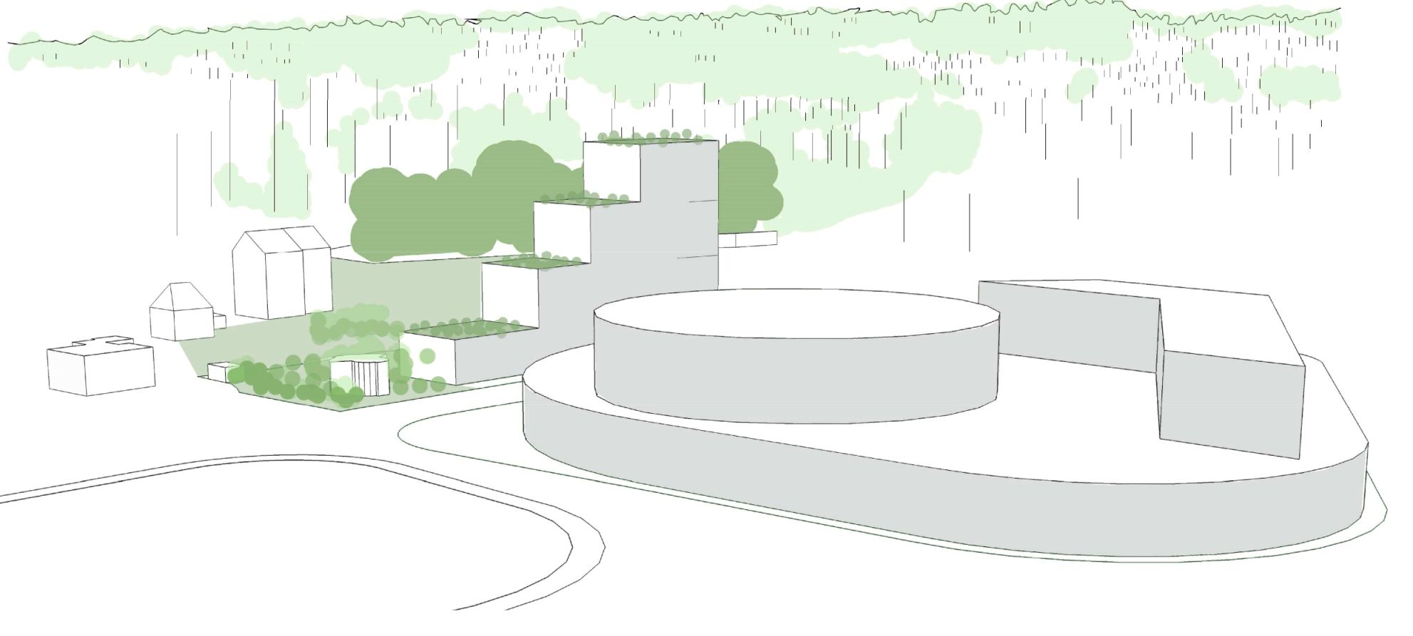
counter-project 2
-
the counterproject implanted in the slope between the road and the plateau is free of the plot pattern (like the other variation) to keep the conch available for a green area in the west part.
-
the volume ascends from the "round house" realizing a front along the road while opening the view for the houses on the back.
- this variation presents a volume ascending by steps as green terraces. the volume shape composes with the AquaEcoPole complex and simultaneously with the residential area.
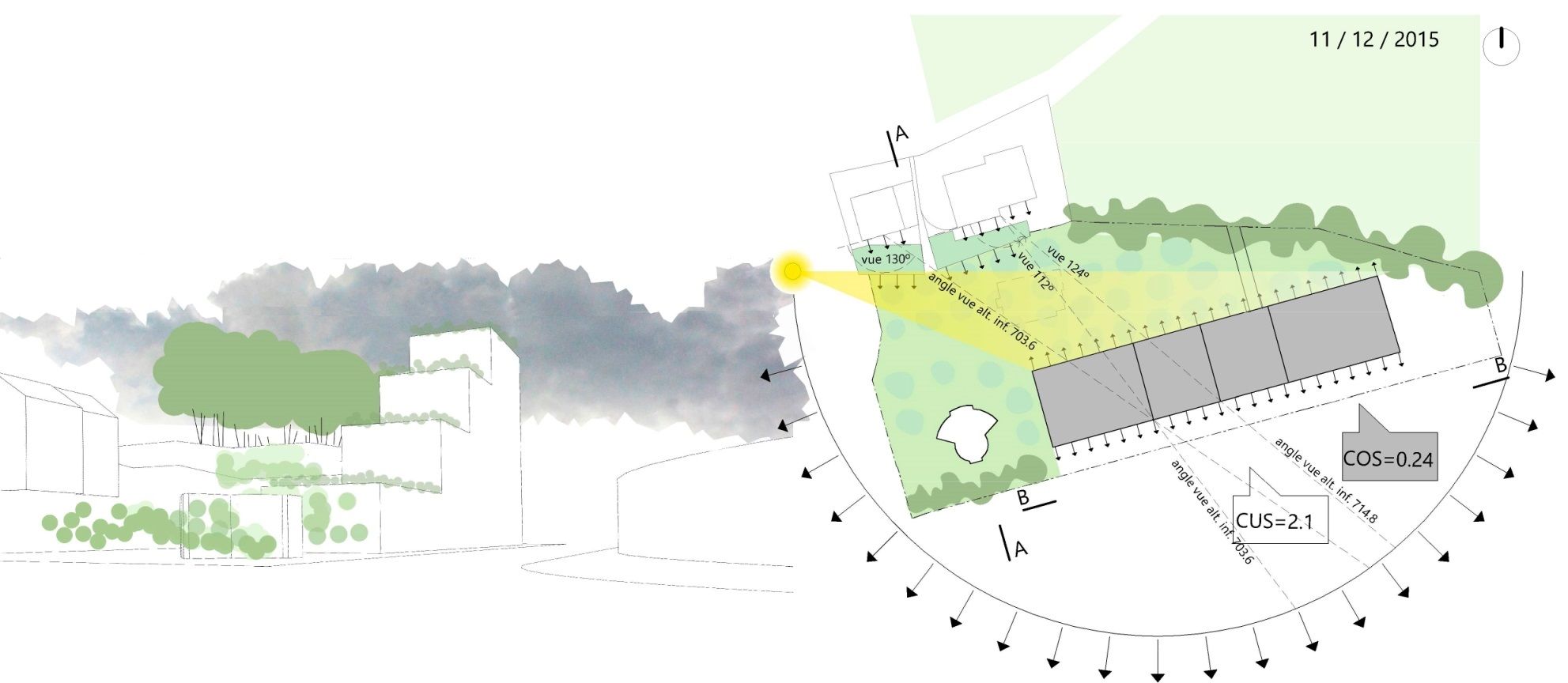
counter-project 2.1
-
the west to east ascending concept allows the view from the road on the registered woodland cord (to compare with contested project).
- above the first and second terraces plots 7315 and 7316 preserve their view within angles between 112 to 130 degrees.
counter-project 2.2
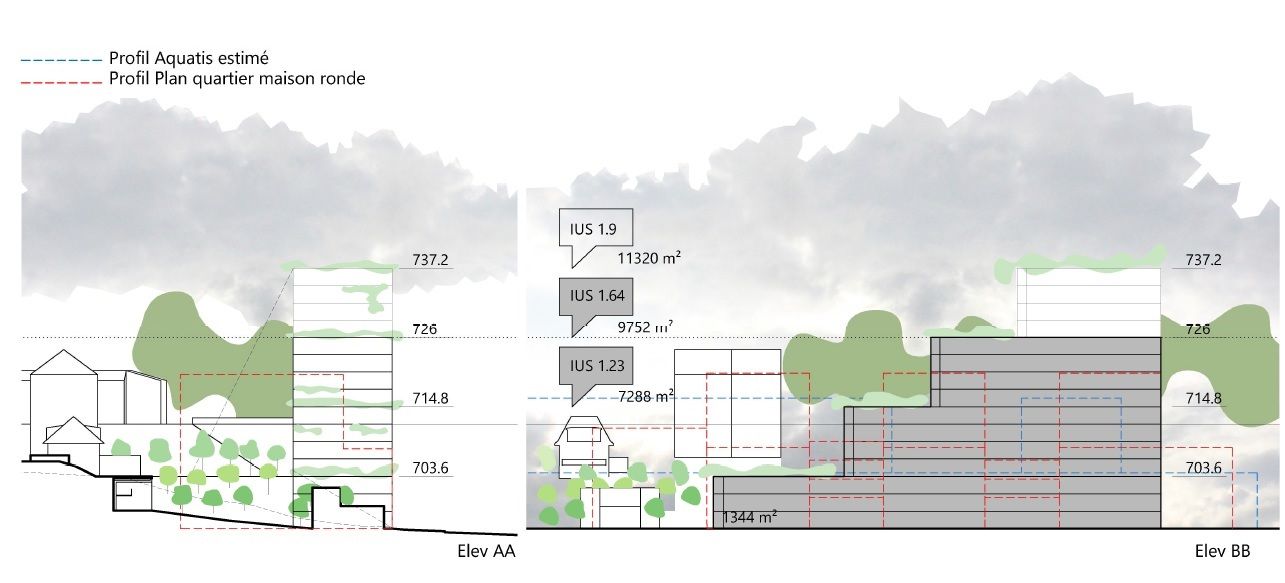
- this variation shown here at the maximum of the volume represents a CUS of 2.1. (the volume such shown here is not plastically optimized).
counter-project 2.3
- one can observe that a volume limited to the last terrace would represent a 1.64 CUS which is very similar to the 1.68 CUS of the contested project.

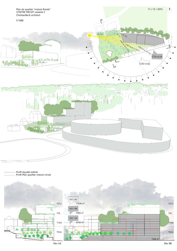
counter-project 3
-
the counterproject differs from variation 1 and 2 by its implantation along the woodland cord with a space in the south which extend the green space of the conch above a platform.
- this variation better composes with the residential zone but the apartments crossing typologies would be affected by the construction of the building in the slope.
counter-project 3.1
-
this variation offer the best view from the plots 7315-7316 with angles between 112 to 139 degrees.
-
the green area of the conch extends in the south of the building.
- in this implantation, the rooms on the backside do not receive any sun.
counter-project 3.2
-
this variation would be possible in the case that the depth of the building would be reduced to 10m in the storeys built in the slope (and the distribution would be done from the backside).
- it would result to a high reduction of the built density.

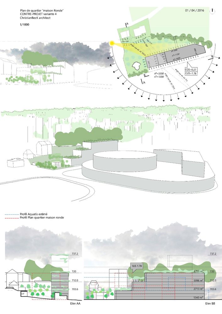
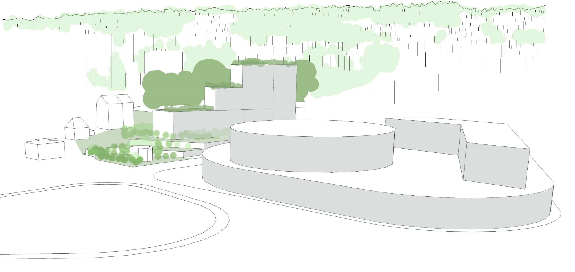
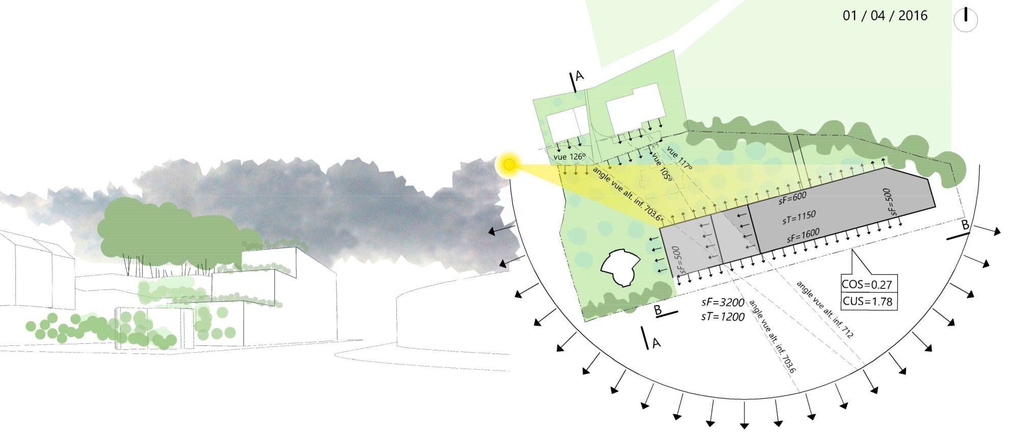
counterproject 4
- this variation demonstrates that the density CUS 1.78 is even reached with a building height limited to the altitude of 720.00 (idem the contested project) and still have a COS of 0.27.
counterproject 4.1
limited at the same height of the contested project, this variation still have the following advantages:
- a. Reduction of COS from 0.5 to 0.24 (common advantage)
- b. the part of the conch become a green zone (common advantage)
- c. Raising of the CUS from 1.68 to 2, éventually 2.25 (PQ's owners advantage)
- d. Reduction of the surfaces façades+roofs >around. 40%=2800m2 > energy saving (common advantage)
- e. Appartment typology apprpriate to noise protection (common advantage)
- f. Appropriate typology to the view and sunshine(PQ's owners advantage)
- g. Preservation of the view on the registered woodland cord (common advantage).
- h. the Round house registered as an architectural heritage is valued in a favorable context (common advantage).
- i. the composition with the AquaEcoPole is still ok to design the entrance of the city, though a higher building (variation 2 p.ex) would be better (common advantage).
- j. … the view and sunshine for 7315-7316 would be preserved (7315-7316's owners advantage).
counterproject 4.2
- with a limited height, the composition with the AquaEcoPole miss some dynamism.
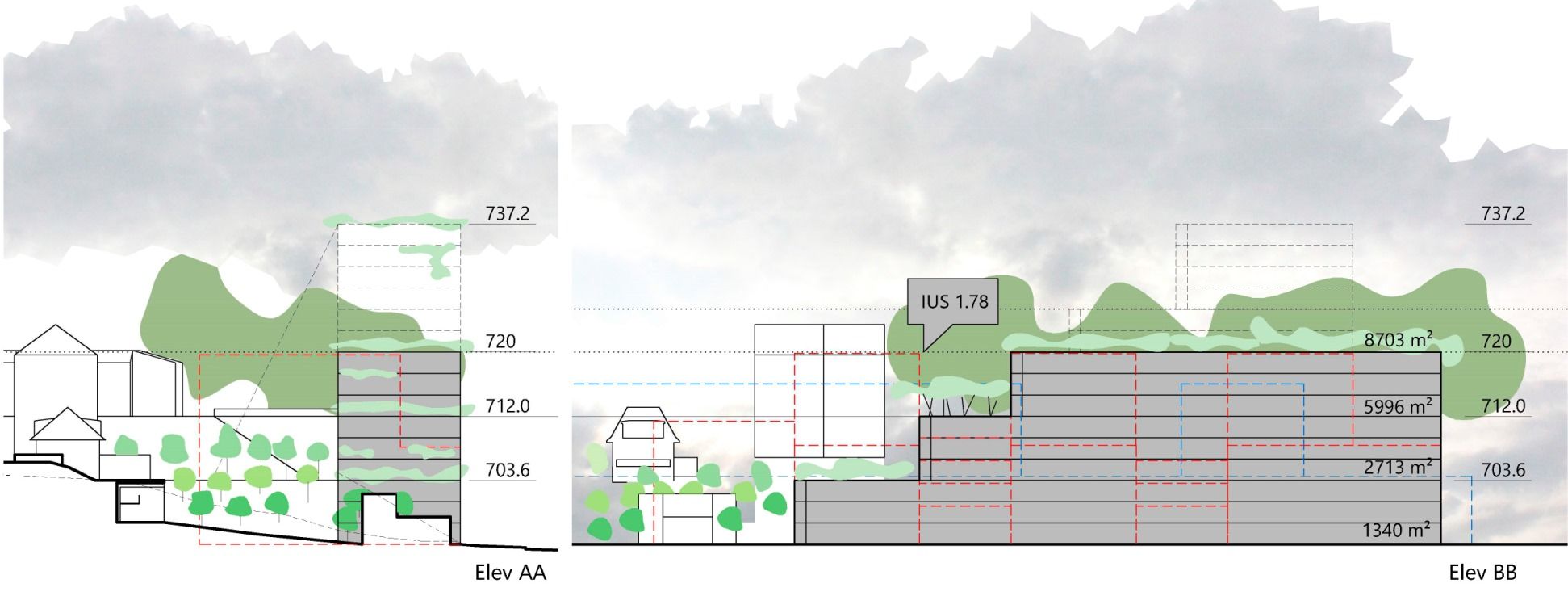
counterproject 4.3
- the counterproject is limited within the contested project maximum height. It reaches a similar CUS (slightly higher of 1.78 with around 8703m2 available floor surface.

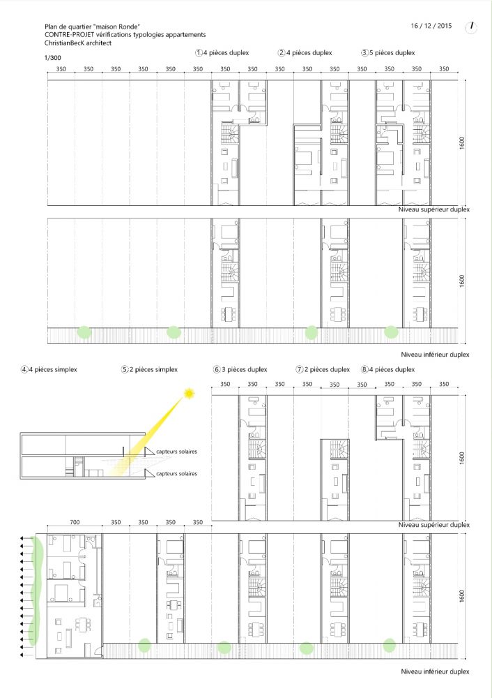
apartment possible typologies
- 16m depth and corridor distribution reach to duplex apartments.


typologies
- preliminary feasibility control.
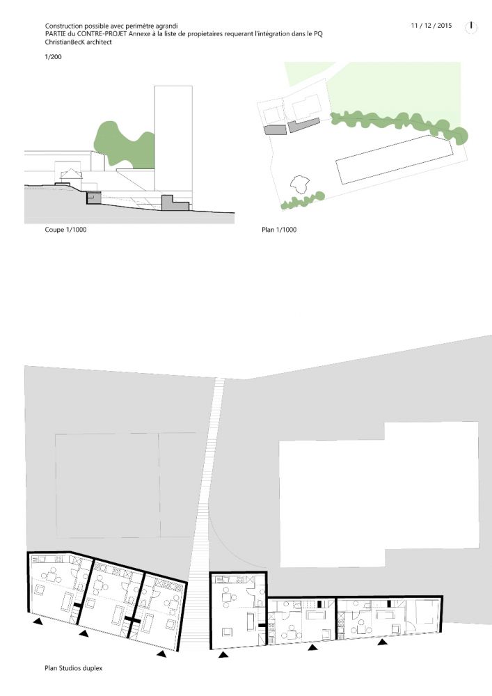
extension of the perimeter
- plot 7315 &7316 would become part of the new neighborhood plan in order to open downstream the spaces already allowed to build underground.


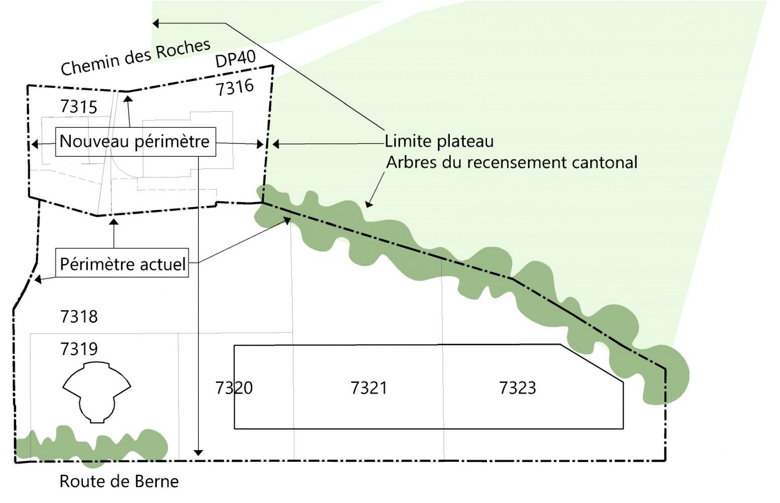
new boundaries